
After numerous visits to the island, Dave (my partner) literally living on the island for a week every summer for over five years, and I visiting him and returning for visits with him, we’ve seen basically everything! With the help of our family, we have determined this to be the PERFECT first time walking tour of Mackinac Island.
Not only is it extremely cost-efficient (you only need to pay for your ferry ticket + an optional lunch) but also you get your steps in! At over 6 miles walked and 25 floors climbed it’s a day to see a lot, but not take up too much time. This entire tour takes about 3-5 hours based on how long you want to stay at certain spots and how fast you walk.
You can take either ferry, but I prefer Shepler’s and the walking tour will start from their dock.

Exit Shepler’s Ferry Dock and walk straight onto Hoban street, crossing Main Street and walking up to Market Street.

Turn right onto Market (so you’re walking NE). Walking along Market is much less stressful and busy than Main Street is, it offers beautiful view of some historic buildings, as well as many Bed and Breakfasts, some shops, and my favorite coffee house, Lucky Bean.
Continuing down Market, you’ll eventually run into Marquette Park and the base of Fort Mackinac. Turn right down Fort St and then take a left onto Main St. You’ll follow down along Main Street, walking past the base of the Fort (on your left) the Marina (on your right), numerous Inns and Bed and Breakfasts, all the way down to Mission Point Resort.

As you approach the grounds for Mission Point Resort, you will turn right onto the gravel trail marked “Shoreline Trail” and follow this until you get back to the paved road (M-185), bear right. Walk until you reach Dwightwood Springs and the stairs up to Arch Rock (which you’ll climb, don’t worry there’s only 200-something).
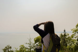
After climbing the stairs, Arch Rock is to the right. Just next to Arch Rock is the Nicolet Watch Tower (just a few more steps to climb) and up there you will find even more beautiful views as well as the Tranquil Bluff Trail which you’ll walk along next.


Tranquil Bluff Trail is a thin, rooted, rocky trail but yields gorgeous views of the lake and forest. Even on an incredibly busy day on the island, there is hardly anyone back here. Follow Tranquil Bluff Trail until it runs into Leslie Ave and make a left. Not soon after this turn you’ll run into North Bicycle Trail and make a right. Follow this trail until you run into Sugar Loaf Rock (trust me, you can’t miss it).

From here you will have a ground level view of Sugar Loaf Rock (seen to the left). But next you will have a view from above (seen below), after following the (unfortunately) steep staircase up to Point Lookout.

From here, you’ll walk along Point Lookout Trail/Fort Holmes Rd, over to Fort Holmes which is the highest peak on the island.

After taking in the breathtaking views, you’ll climb down stairs (finally) and turn left onto Rifle Range Rd and then right onto Rifle Range Trail. Continue walking until you run into Garrison Rd, you’ll walk behind the Scout Baracks and continue right onto Harrison Rd to walk behind Fort Mackinac.
After walking all the way down Harrison, you will run into the Governor’s Summer Residence and make a left here onto Fort St. (Note: this is WALKING ONLY, if you have bikes with you they must be walked, this is a huge, steep downhill). Continue down to Main Street and wander through any shops, if you’re hungry at this point and didn’t pack a lunch, at the corner of Fort St and Main St is Doud’s Market, they have prepared food, including hot pizza for $2.75 a slice.

This pretty much concludes the walking tour! The two ferry docks are on Main St, so you can continue to wander or head back to the mainland. This walking tour can take anywhere from 3-5 hours depending on how fast you would like to get through it, breaks you want to take, etc. I hope you enjoy it, and find it useful! Please refer to the map I’ve posted with the walking tour in green, starting at the yellow dot and ending at the blue dot!
Leave me your walking tour suggestions for Mackinac Island below or on Instagram!